Snow Mountain, aka Xueshan (雪山), which stands at an altitude of 3886m, is Taiwan’s second highest peak. It is located along the Snow Mountain Range (雪山山脈) which stretches from the north county of Yilan (宜蘭) to the central county of Nantou (南投). Xueshan is part of the Shei-Pa National Park (雪霸國家公園) and to get there, you will need to reach Wuling Farm (武陵農場) which is the start point of the trek. The entire trek takes a total of 3 days with the 1st day mainly on getting there. The 2nd and 3rd day is where the long hours of trekking are and taking on the summit. .
 |
| Sunset at Danshui |
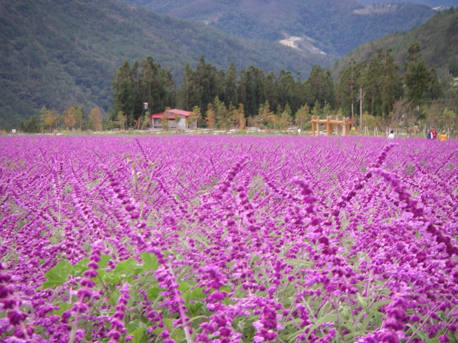 |
| Sea of lavender at Snow Mountain Park |
 |
| Lavenders in bloom |
There were patios and patios of lavender decorating the driveway to the visitor centre as we drove past them. The weather has cleared up and there were lots of radiation from the sun’s rays. This was much preferred than the cloudy and wet weather in Taipei. It was a weekday and there were still tour buses parked at the visitor centre.
 |
| Great weather at the National Park |
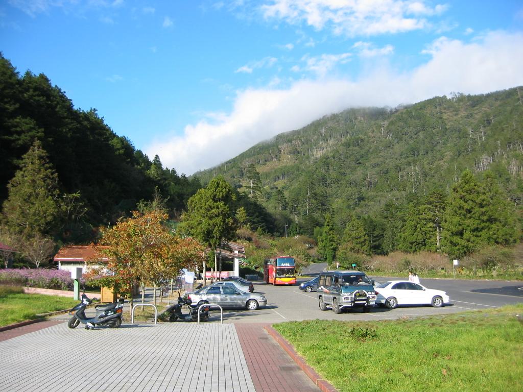 |
| Carpark area if the Park HQ |
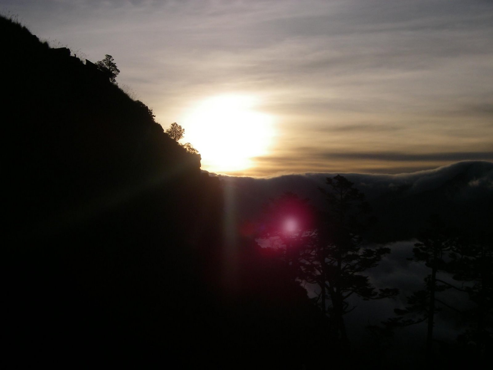
After our lunch, we drove further into the Wuling Farm to the Snow Mountain Administration Office at the farthest end of the road. The office (see above) is located on the slopes of the mountain, over looking the opposite mountain range. The view was really breathtaking. You could see the clouds pouring down on the mountain and the evening sun (around 5pm) casting a shadow of the mountain behind us on the opposite mountain.
 |
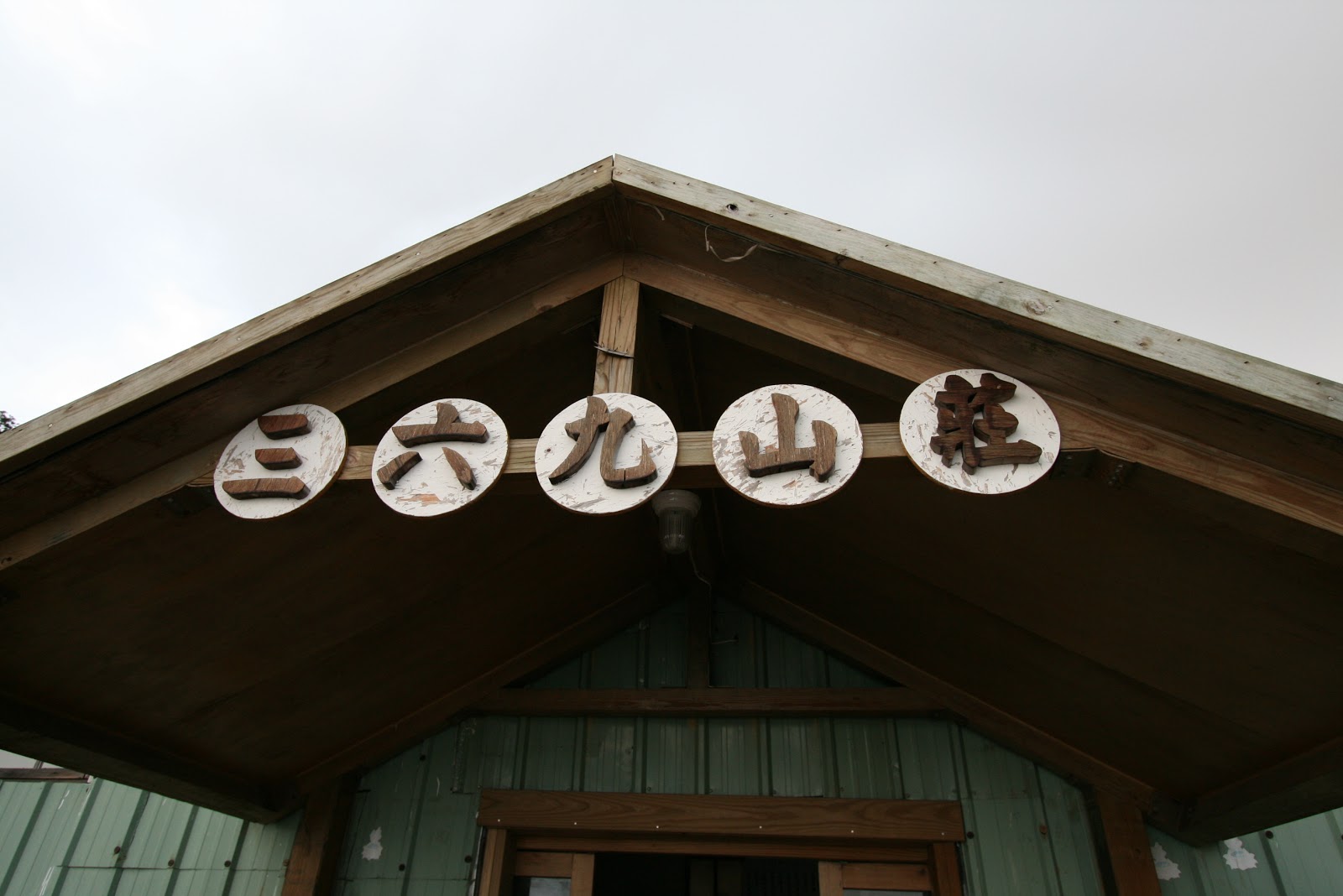
| Reporting station for the climb (watch a video) |
 |
| Afternoon view at the trailhead (reporting station) |
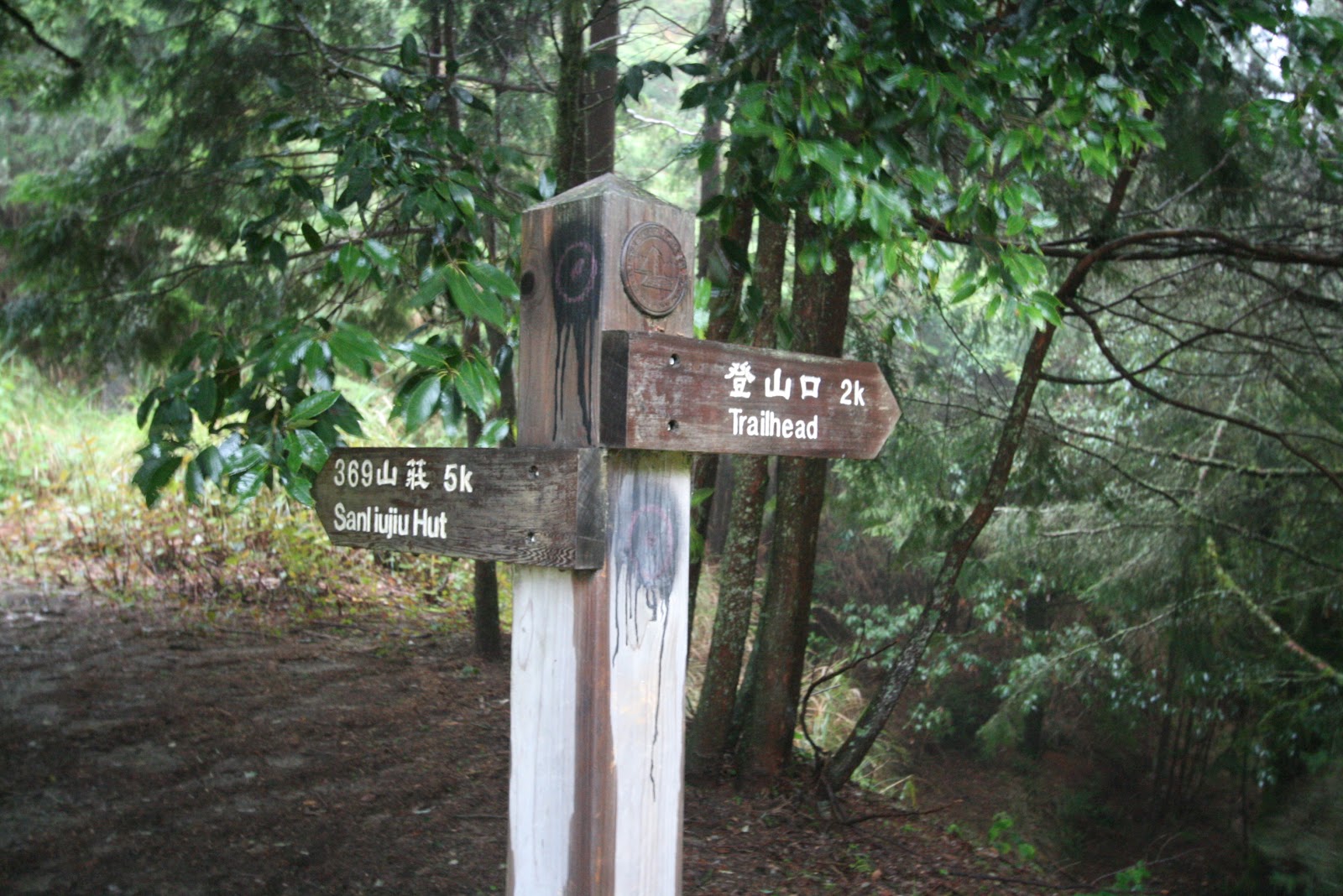
On Day 1, after discussing with some other trekkers, some have opted to take the quick approach to reach the summit. The approach was to dump all the heavy backpacks (food esp.) at Chika, and make a fast and lightly loaded accent to the summit. This will take less time without the load and make it back to Chika by nightfall. The original plan was to rest the night at the 369 mountain lodge which is the lodge closest to the summit. The reason to take the alternate approach was to overcome the steep and tough trek between Chika and 369 lodge. Doing a round trip from 369 to the summit requires about 3 hours. Hence we took the alternate approach and started our day 2 trek with a light load.
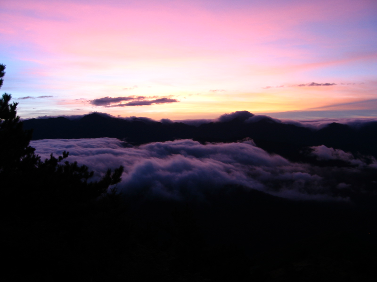
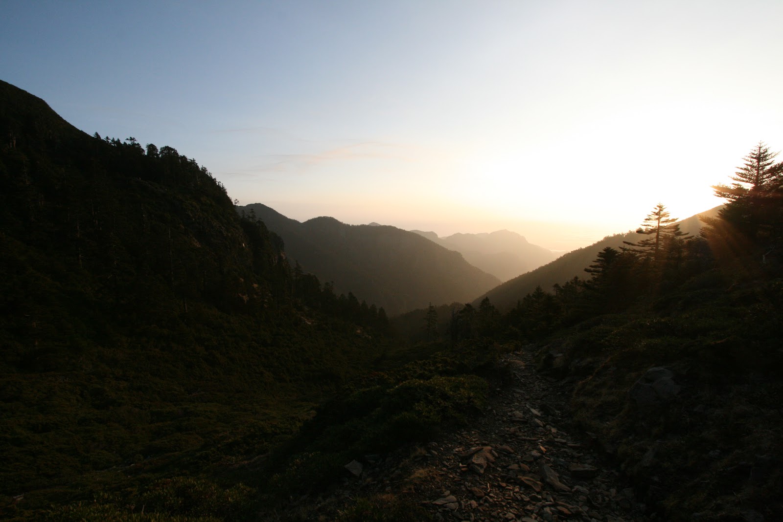
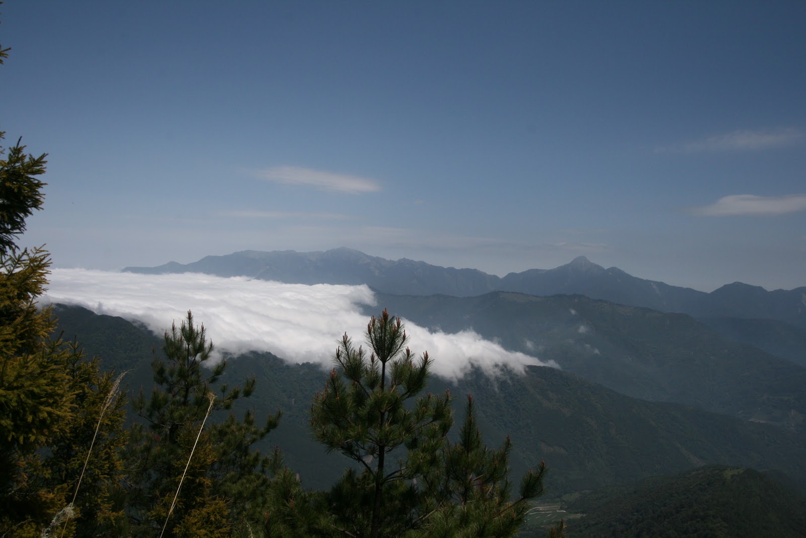
At 3am, we moved off from the Chika lodge and made our way through the forested trail behind the lodge. It was pitch dark and headlights or any torchlight is a must to trek at this time of the morning. The trail started off gentle and as we moved higher, the trail became much rocky with loose rocks. As we came out of the forested trail, we came to a clearing and we can clearly see the opposite mountains that we saw at the trailhead. Little sparkle of orange street lights came from the Wuling Farm below us. A check on my altimeter watch showed 2700m. There was a viewing platform at the clearly where we can see the skies starting to brighten up. The layers of cloud seemed motionless, sitting on the peaks of the mountains.
 |
| Sunrise while on the trail |
 |
| Morning sea of clouds |
 |
 |
| Here the sun rises from the clouds |
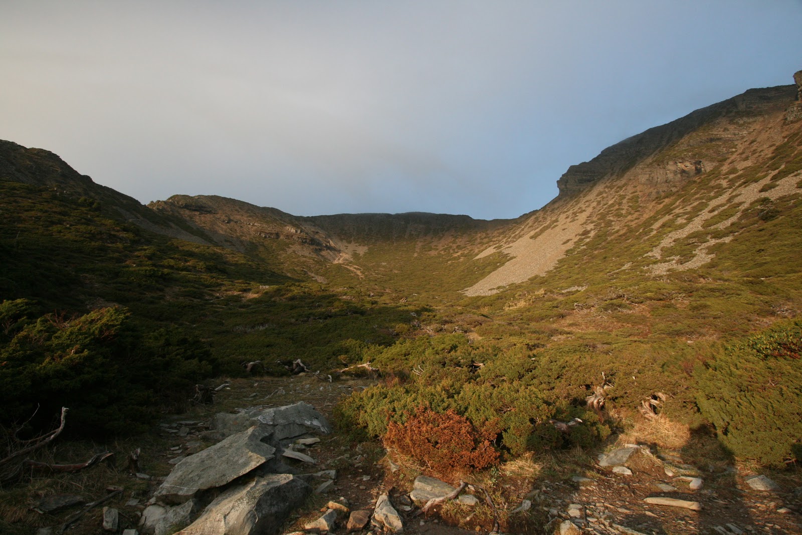
After a quick break and some light snacks, we were on our way up the steep slopes of the trail. This is the part of the trail where they named it 哭坡。After overcoming this leg of the trail, one can understand the strenuous effort to the extent that you can cry over it.
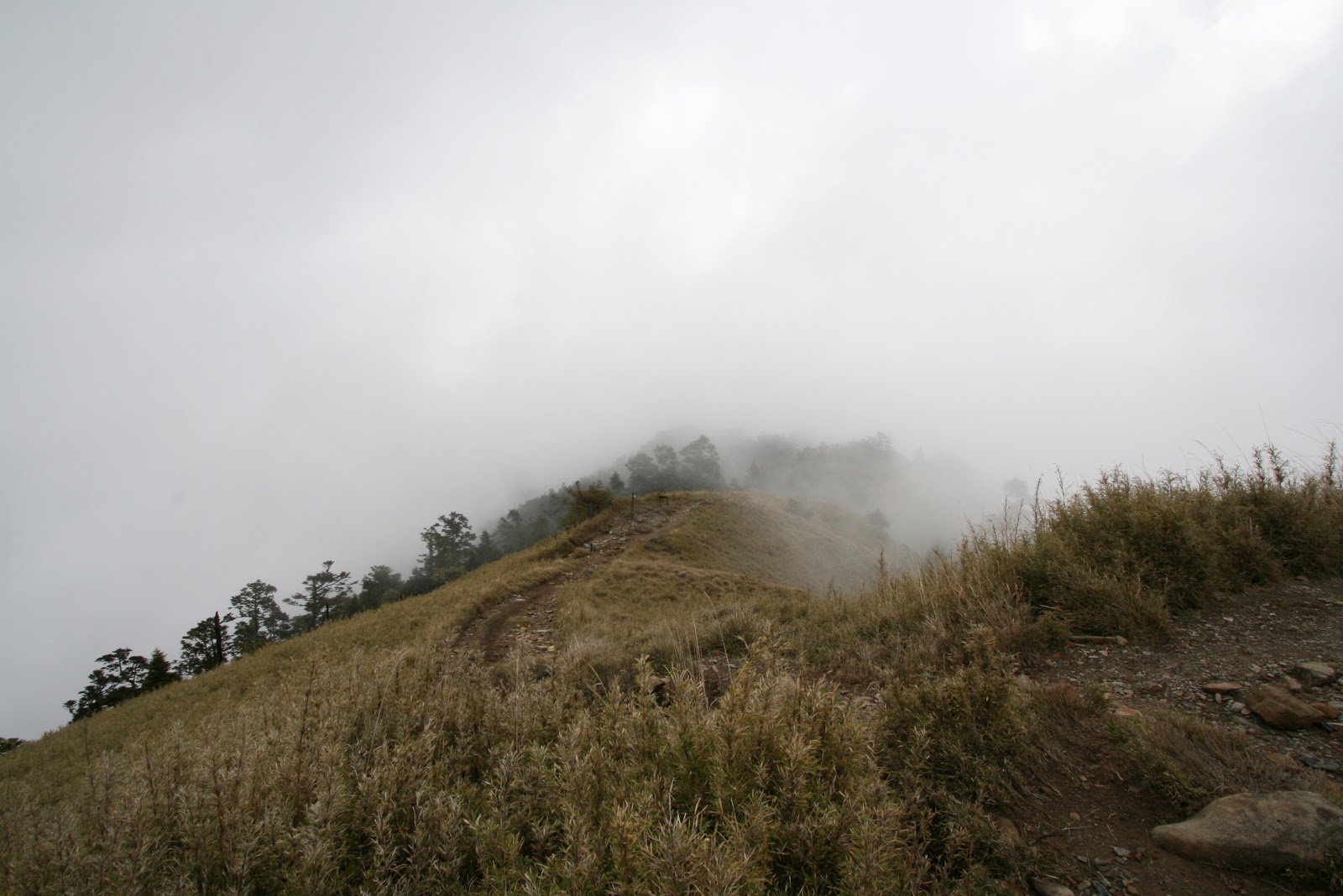
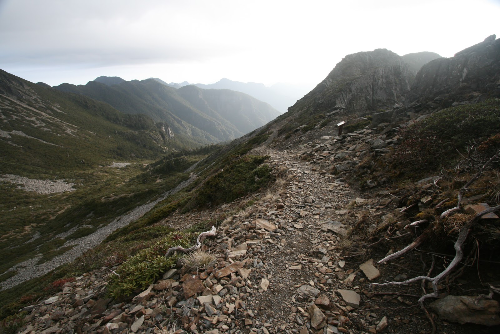
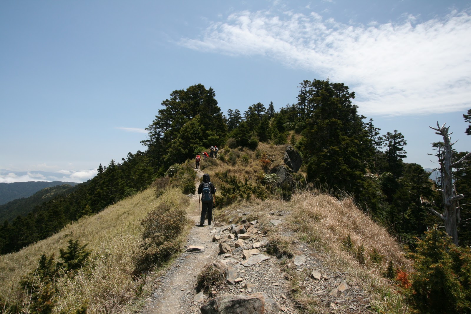
The trail after哭坡 was less strenuous, but there were still some roller-coaster trails for us to clear. The trail at the point was narrow as it run along the ridgeline. We can see both sides of the slope as we tracked carefully with our hiking sticks along the ridgeline. After another 2 hours, we reach our first peak. The XueShan East peak (雪山東峰, 3150m). The weather was great and we could see all the distant mountains that surrounded the spot where we stood on. The sun was a great welcome as we warmed ourselves by doing a bit of sun tanning.

 |
| At the Snow Mountain East Peak |
 |
| On the trail to the lodge 369 |
 |
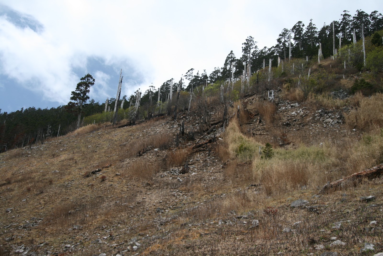
| Remnants of previous forest fires. |
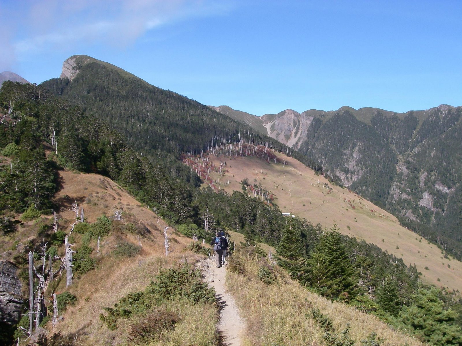
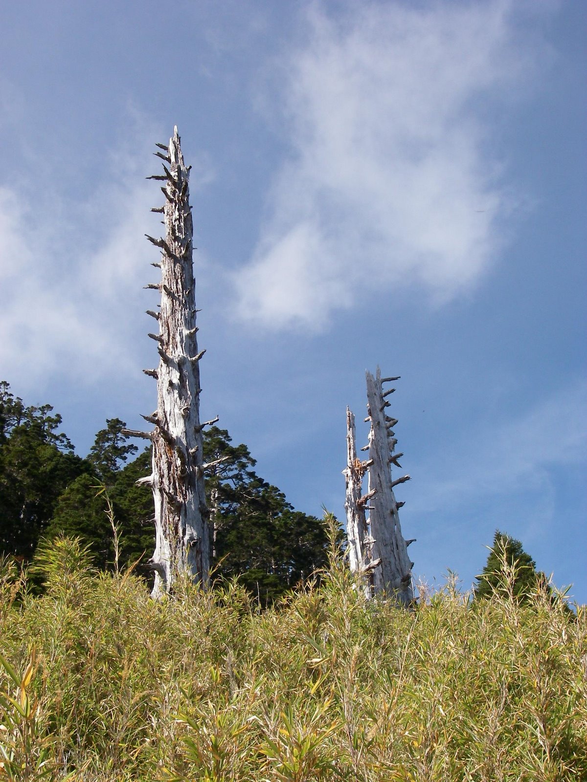
As we got closer to 369 lodge, there were some interesting ‘white trees’. Did hear about some fires many years back that created some phenomenon. Just behind the lodge, there were some trees already in dull red color, readying themselves for the coming winter. It took an hour from arrived at lodge 369 from the eastern peak. The lodge was quite empty except for loads of backpacks stack in the bunks. Many of the trekkers have made off for the summit for view the sunrise. They must have rested for the night at the 369 lodge prior to the ascent to the summit. We took our light meals at the lodge before setting off for the summit. Taking the zigzag trail behind the lodge, we made our way to the black forest (黑深林). Once we entered the black forest, we can felt the temperature dropped because of the lack of sunlight due to the thick canopy of the forest. There were lots of dead fall, fallen trunks were laid across the slopes of the forest. After making through a few hundred meters into the forest, we and our mountain guide friend decided it may not be wise to carry on because of the change in weather and the amount of time left to get to the summit and make our way back to the Chika Lodge. Because we chose the alternate approach in reaching the summit with light load, we left our sleeping gears back at Chika lodge. If we push on towards the summit, we may be making our way back to Chika in the dark. A decision was made to head back. We were so close to the summit, yet we have no choice but to make our way back to Chika Lodge. If we had followed the initial plan and sleep for the night at 369 lodge with all equipment. We can make it to the summit and make our way back to the trailhead all in one day. As our guide told us, “The mountain is always there, you can come back again”.
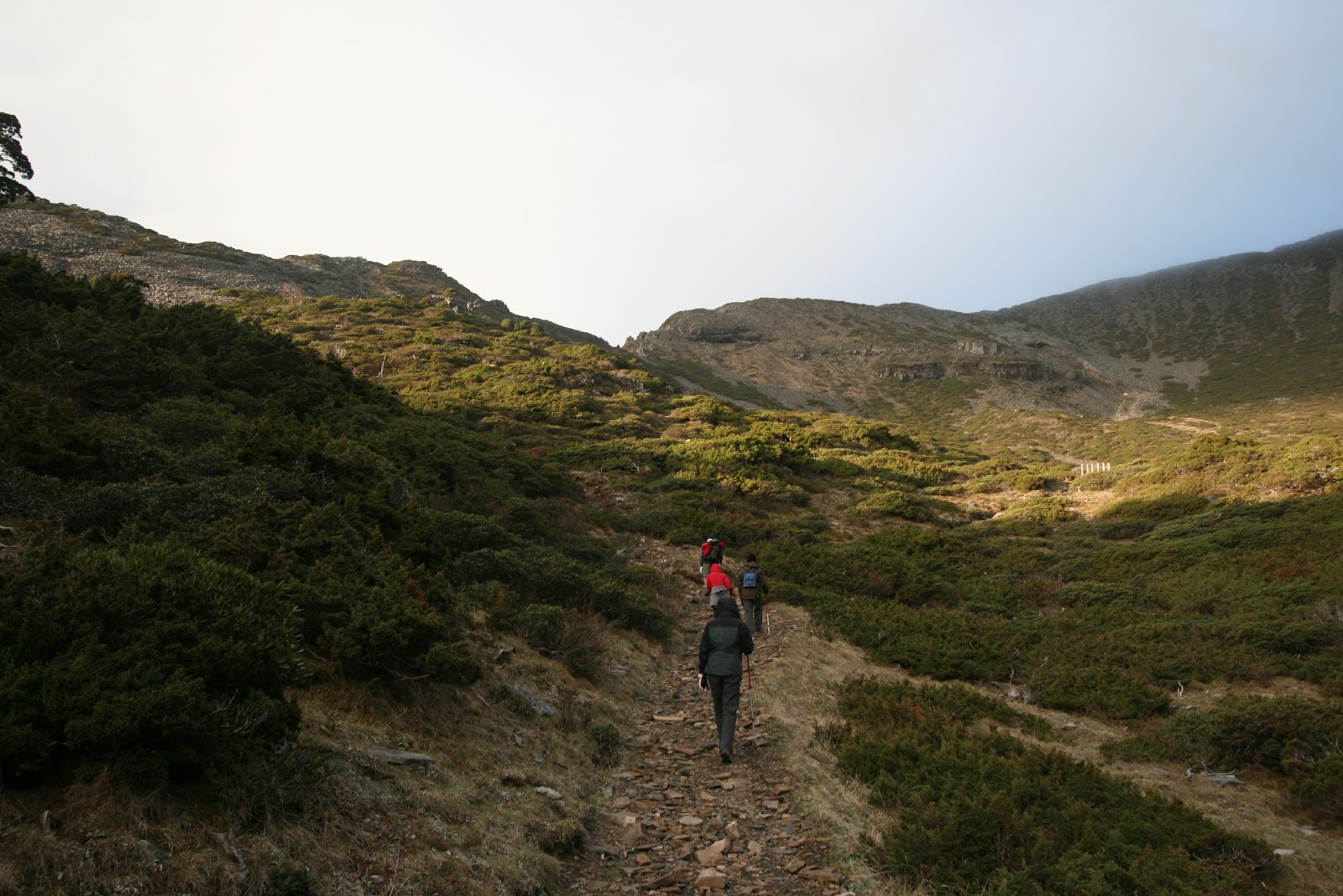
The descent was a quick one, our pace of footsteps increased as we made our way back to Chika Lodge. When we reached the viewing platform after descending from KuPo (哭坡), I took a photograph of the other trekkers making their way down.
 |
| Groups of hikers descending the 哭坡 |
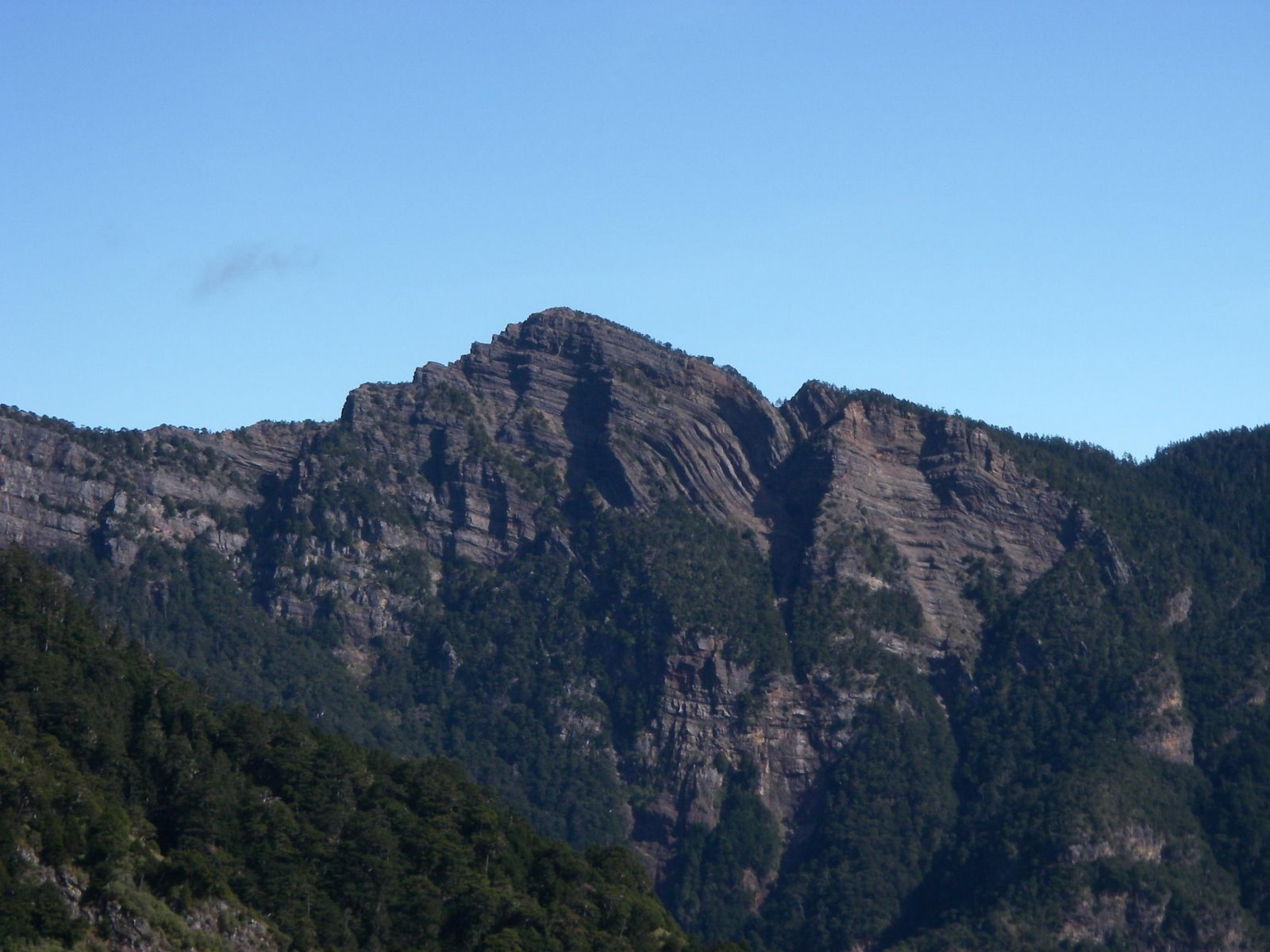 |
| Snow Mountain Peak? |
We rested for the 2nd night at Chika Lodge before making our way back to the trai lhead on day 3 morning. Our mountain guide friend gave us a ride to Taichung which was our next destination for our trip. I believed there will be a time when I will come again and put my trekking shoes on Snow mountain again.
If you are interested in Snow mountain and planning to get your friends for this trek. Just drop me a mail, I can help you make the arrangement with my mountain guide friend. Maybe I will join in as well.
2nd Climb on Snow Mountain (2009)
We came back to scale snow mountain with a group of friends this time round around Nov 2009. Weather was bad for the start from the trail head to the first lodge of Chika. Luckily the initial day’s walk was just 2 hours from the trail head to the Chika Lodge where we spent the night since it was already afternoon time when we departed from Taipei in the morning.
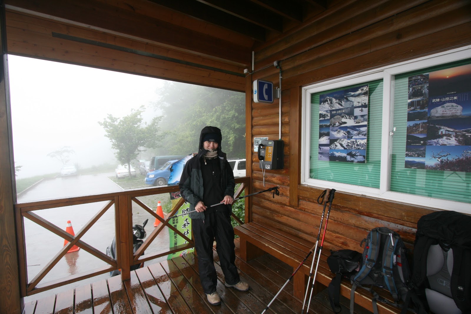 |
| Rain & Mist all around |
 |
| At the Chika Lodge |
 |
| Chika Lodge |
It was a hot soup and rice for dinner before the night’s rest.
 |
| Next morning climb. Misty and windy (less the rain) |
The next morning, the rain has stopped but it was still very misty and windy. Nothing much to see, no views. Just walking in the fog. The trail was wet due to the heavy morning mist, but the air cool and fresh, good for the lungs when doing such exercise. When we reached the steep KuPo (哭坡), the wind was very strong. There is a big resting platform for hikers to enjoy the mountain range view, but there was no view at that time. Still we rested a while there but couldn’t stay too long as it was freezing cold because of the strong wind.
 |
|||
| At the Snow Mountain East Summit(Bags all around) |
 |
| At the summit (east peak) |
 |
| Path that continues on to Lodge 369 |
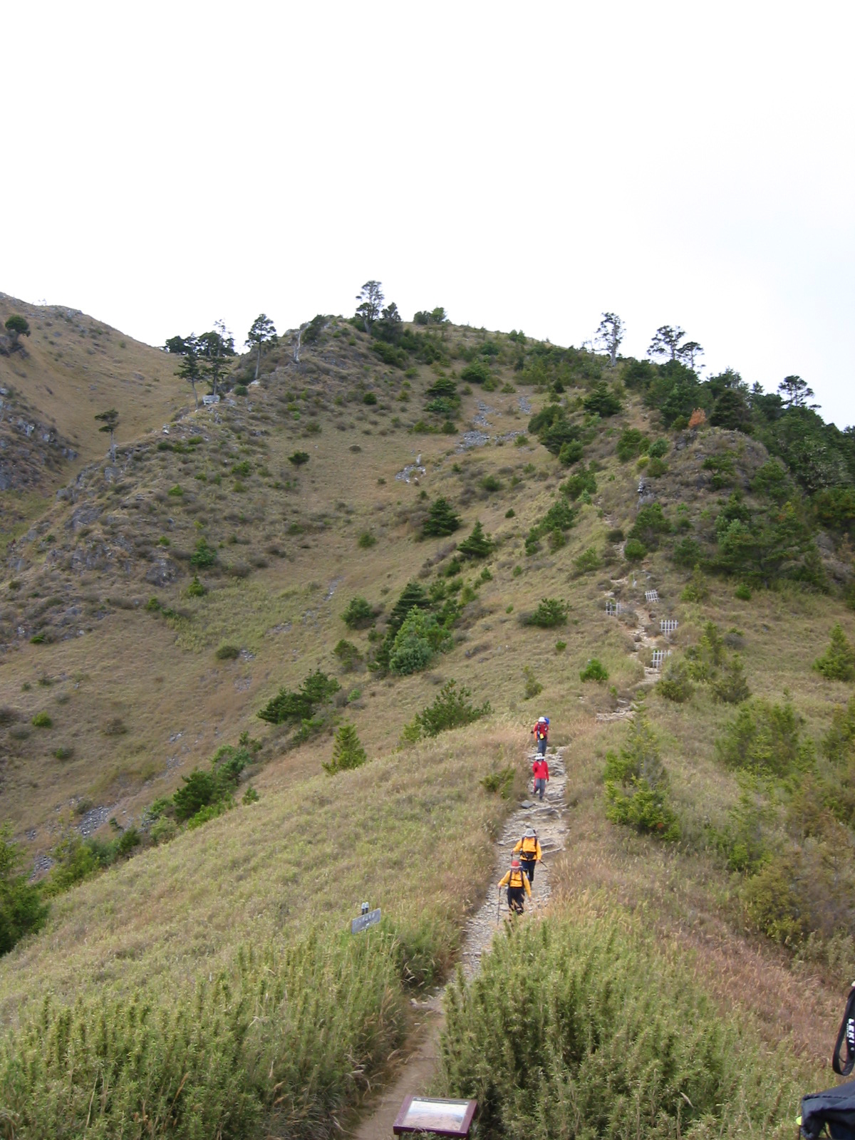
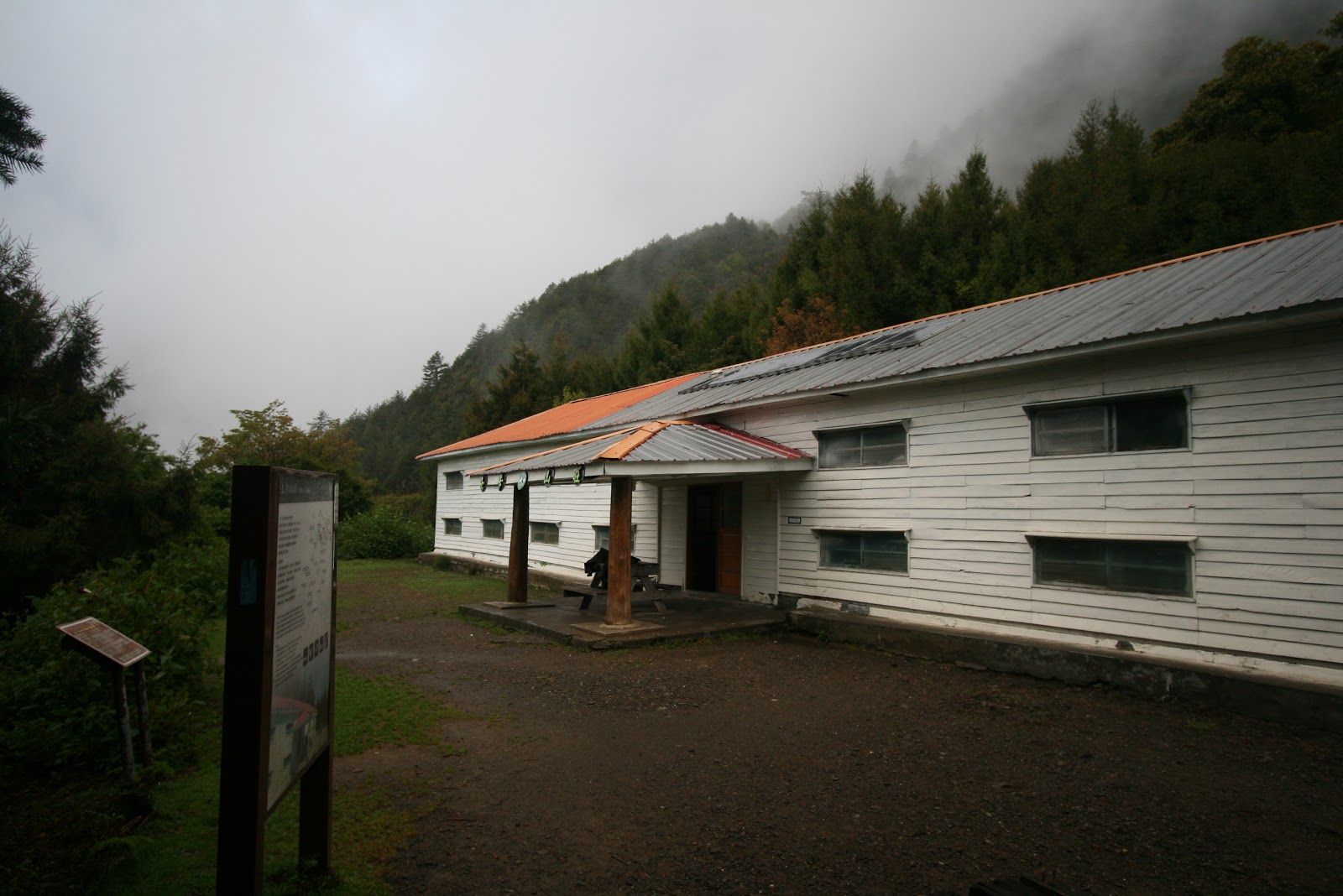
After clearing the KuPo, it was only a short hike up another trail that we reached the East Peak of Snow Mountain. Bags off was the first thing and everyone went to take picture with the signage of the summit. The weather has cleared up a bit. no more strong winds, except that we were still surrounded by thick clouds. There was some short duration of the sun breaking through the clouds. From here it was downhill all the way to lodge 369. Come to think of it, shouldn’t be going higher and higher? Lodge 369 is located at a lower altitude than the east peak. It was a easy hike through the forest area again and once we emerged from it, we could see the lodge 369 just a short distance away.
 |
| SanLiuJiu (369) Lodge |
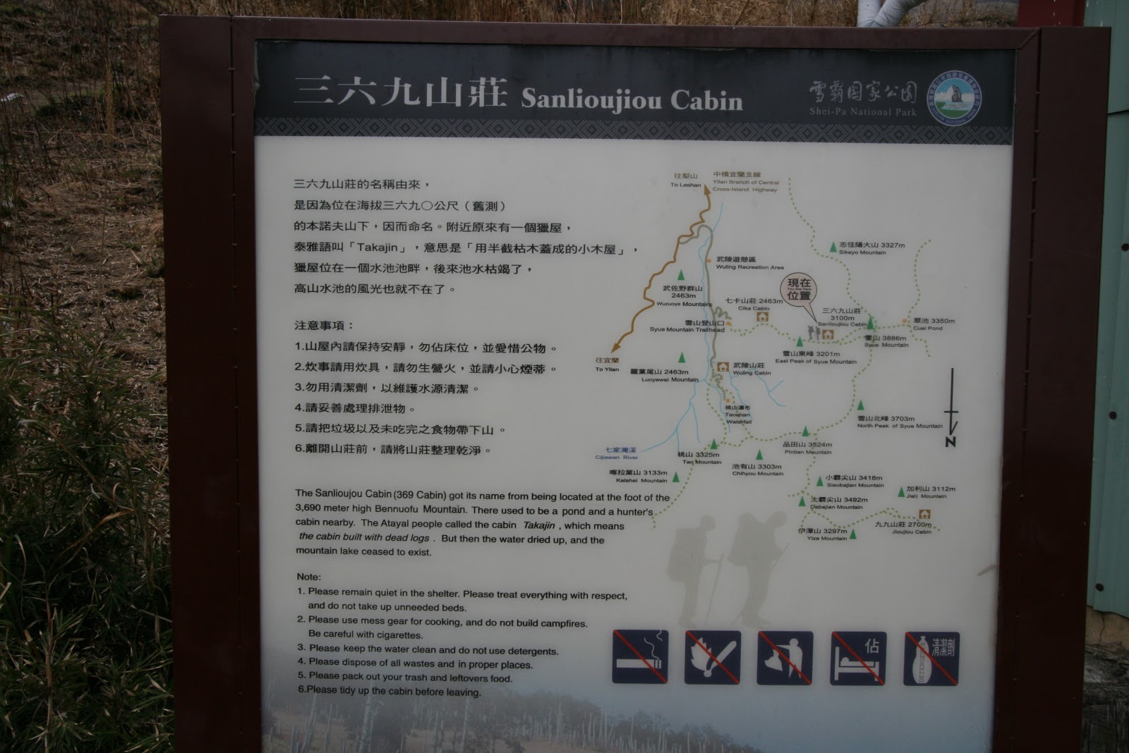 |
| All about 369 cabin |
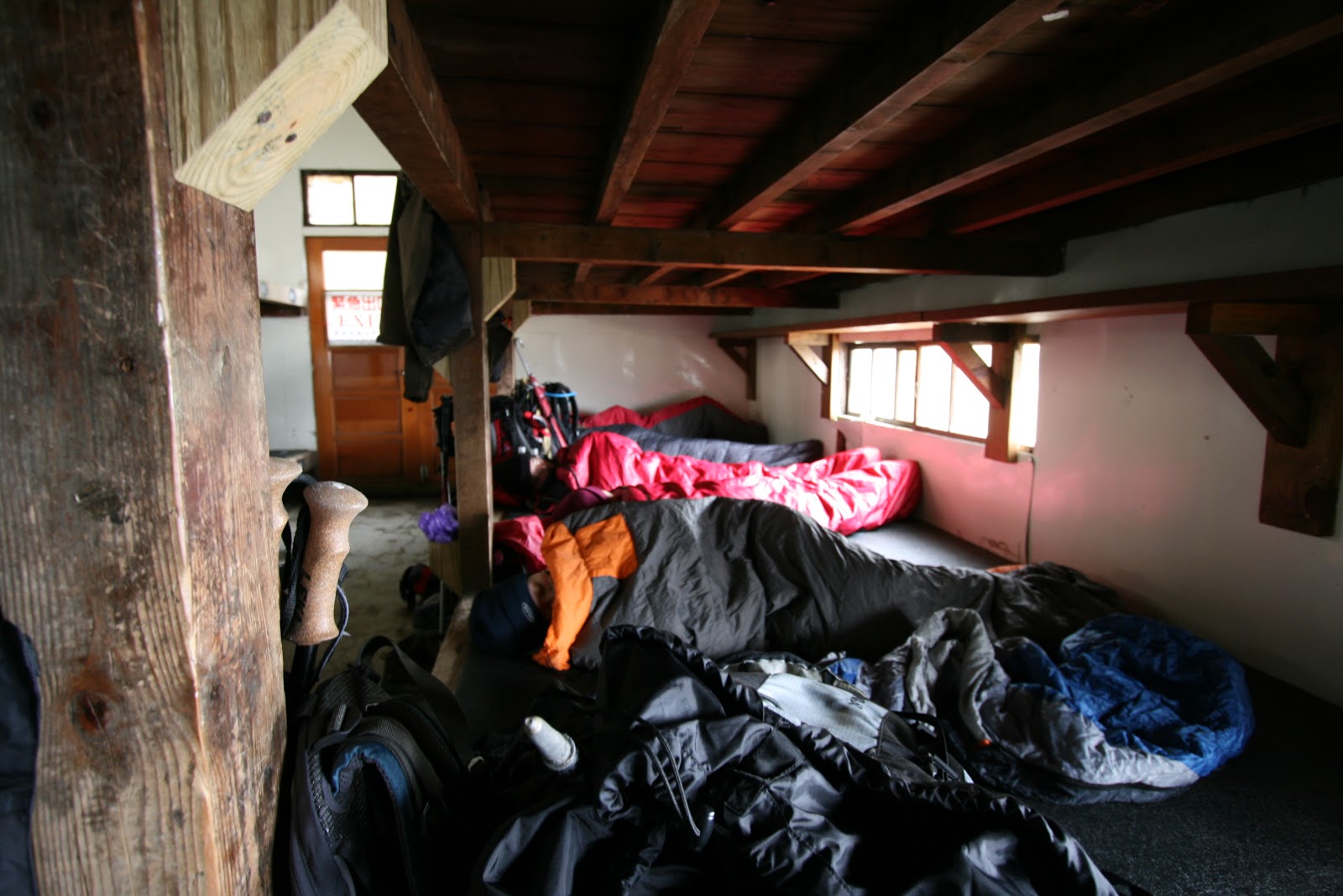
It was still cloudy but the weather was calm and cooling. It was about lunch time (12noon) that we reached the cabin, we quick meal from our dried foodstuff and off to the bunks to rest since there was nothing else to do. The guide did ask if we want to go for the summit since we had so much of time. A round trip to the summit and back could be 4~5 hrs. But with the dark clouds above and did not think there was much to see, we preferred the original plan and waited for the next morning summit challenge.
 |
| Cold and freezing. All wrapped up |
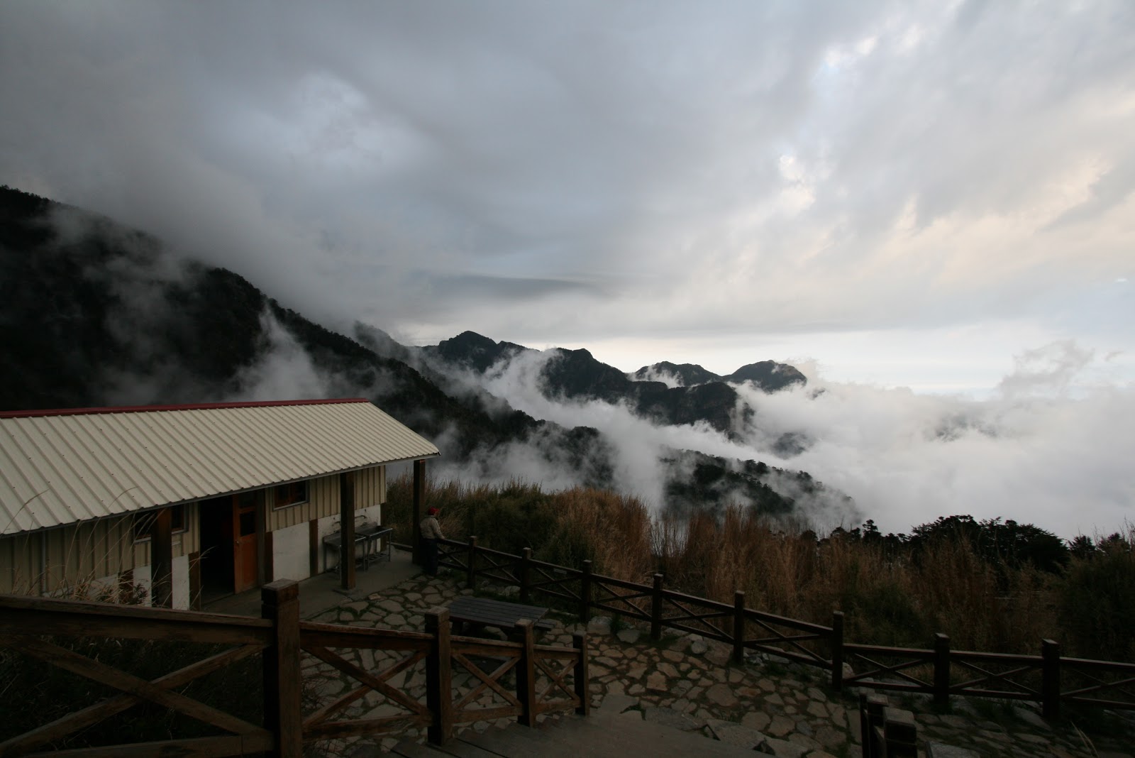 |
| Sky clearing up during dinner time |
 |
| 369 cabin |
The cabin itself, I could only say it was not very well maintained. There wasn’t a caretaker like the over popular Paiyun cabin (Mt Yushan trek) and the interior does need a makeover. Luckily it was not peak season and we were the only group in the cabin. Over at evening time a few more small groups came.
The next morning, we started the hike at about 3am, walking through the mysterious Black forest. There were incidents of hikers getting lost in the past, but not the path is more well fence up so that hikers don’t take the wrong path at night. Why it was called black forest was because of the dense forest vegetation and it canopy blocked out much light from the skies. Well i would say it may be some exaggeration over the description. The climb was steep and at times some members need to slow down to rest a bit. In the end, we missed the sunrise at the summit, but we were able to see the golden yellow sunrise painting the mountain valleys. The sight was warming and comforting even though we were not at the top.
 |
| Sunrise in the mountains |
 |
| Valley in sunrise lighting. Summit on the left |
 |
| Taking the trail to the summit |
The open area was vast and view was stunning. It was like we were surrounded by a wall of mountains and it made us feel so small and insignificant. The trail on the left started to climb and lead to the summit. The trail actually goes up a rather difficult slope to the ridge line of the mountain top where the summit point lies.
 |
| Nearing the top ? Not yet |
 |
| The trail we took. |
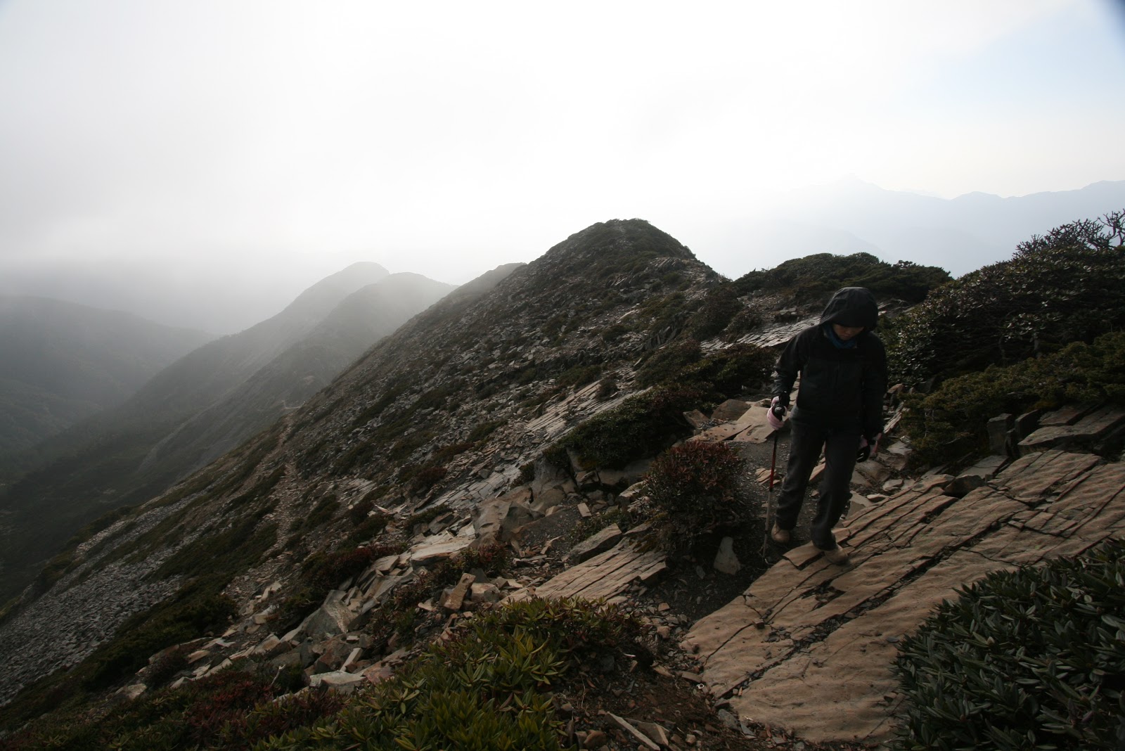 |
| Walking along ridge line |
As we near the top, there were more of broken rock piece similar to those that could be found in Yushan. Small little rock plates. Surprisingly there were little alpine shrubs that could within the cold up at that altitude.
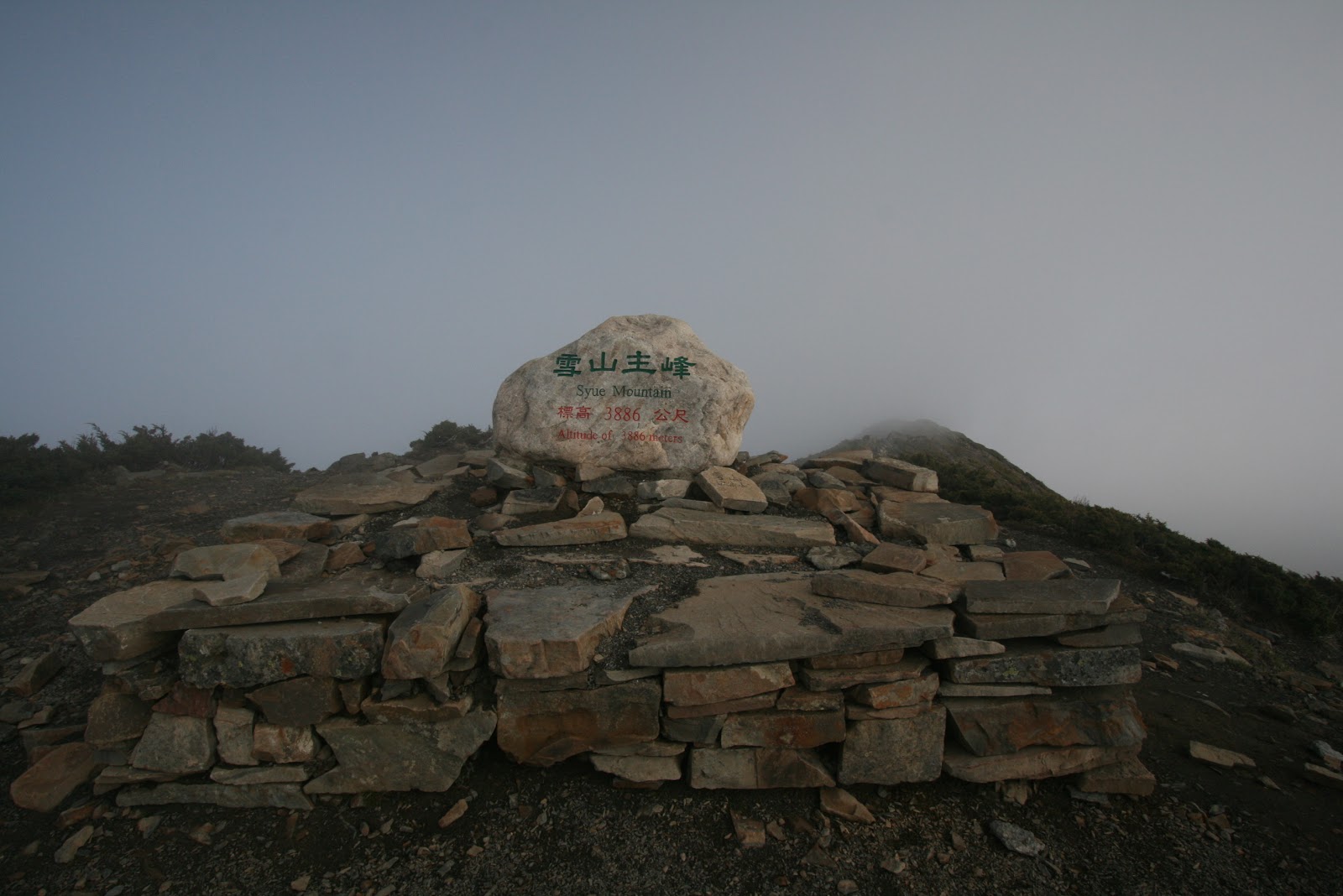
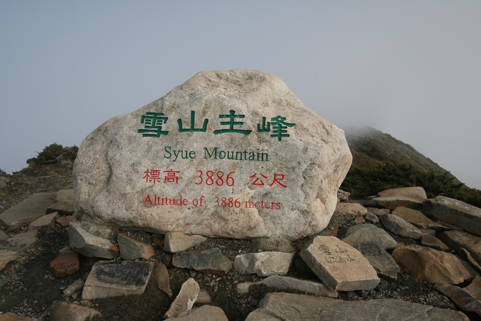
Finally, the summit of the Snow Mountain (Syue Mountain). Weather may not be the best but it was good enough for us. We could see the clear blue skies above, and ocassionally clouds came and covered us momentarily. There seemed to be a narrow passage for the clouds to come from once side of the ridge and got vapourised once they cross over.
 |
| Holy O trail, Ridge line trekking |
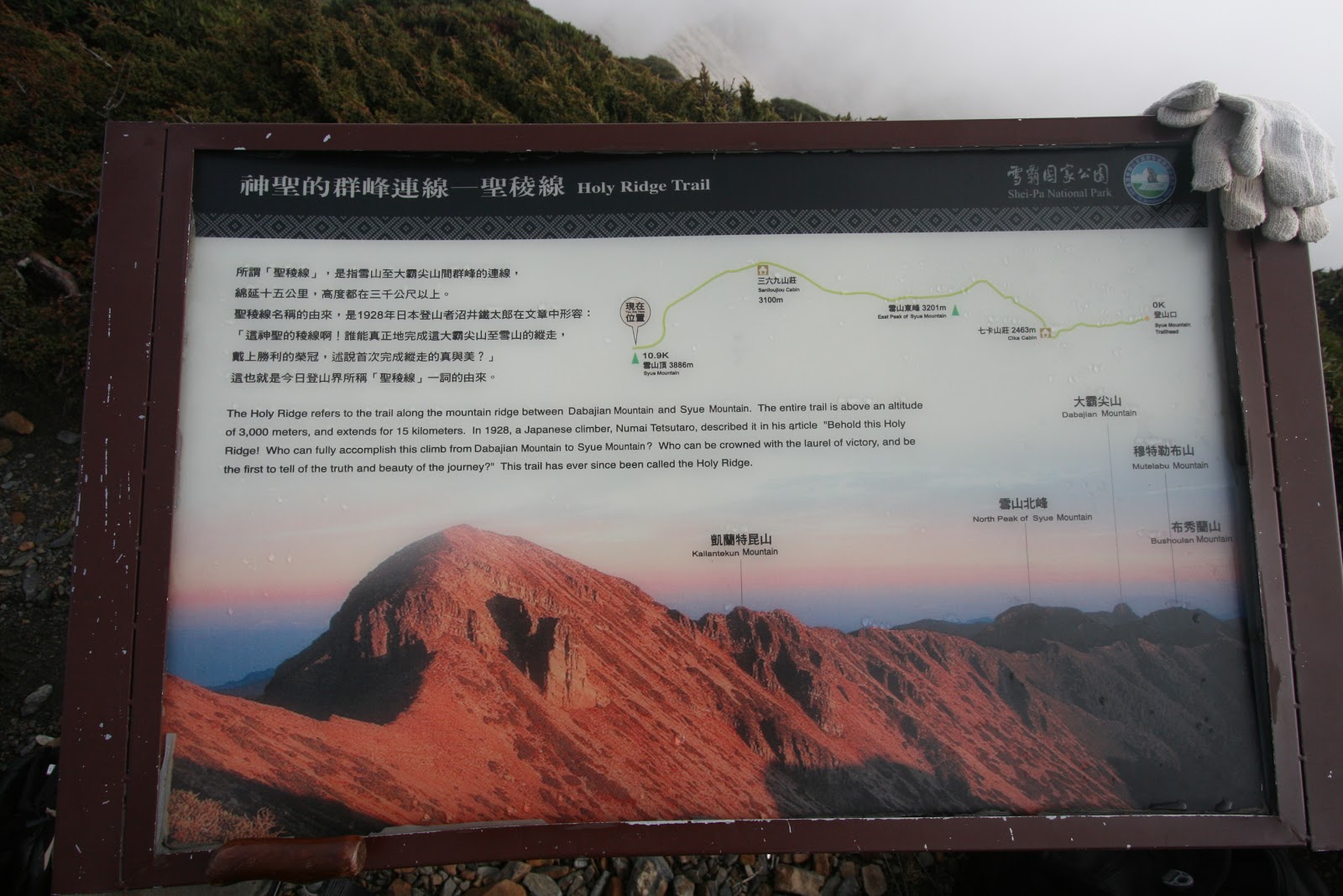
There was a signboard explaining the ridge line trek from Snow Mountain all the way to DaBaJianShan. It was just our group at the summit, meaning no one came to see the sunrise on time. My guess was to see the sunrise, one has to start the climb earlier from 369 cabin
 |
| Another group just arrived at the summit. Brewing coffee |
From here it was all the way back to 369 cabin and to Chika before the car park for the drive back to Taipei where the yummy food was waiting for us.
The black forest when appeared in daylight look inviting and cooling, being the only place to give us shade from the sun ever since it came out in full as we started the descent.
 |
| Walking thru the Black Forest |
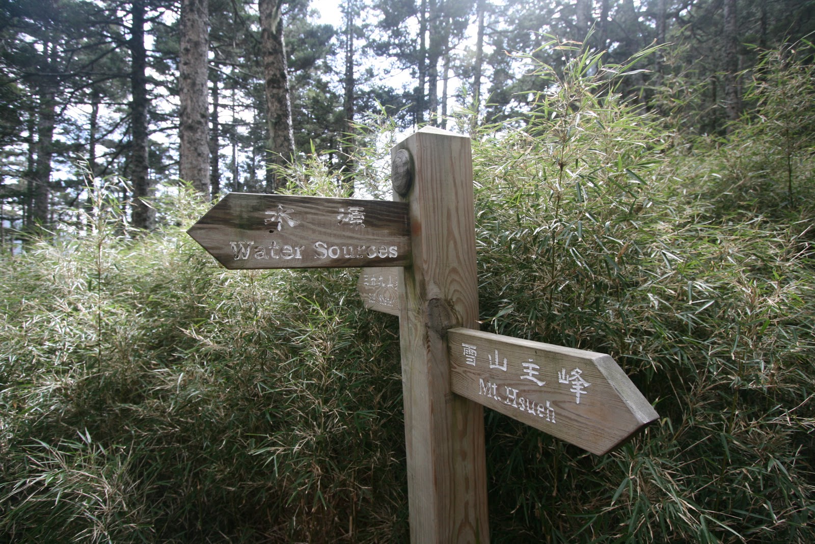 |
| Some directional sign boards |
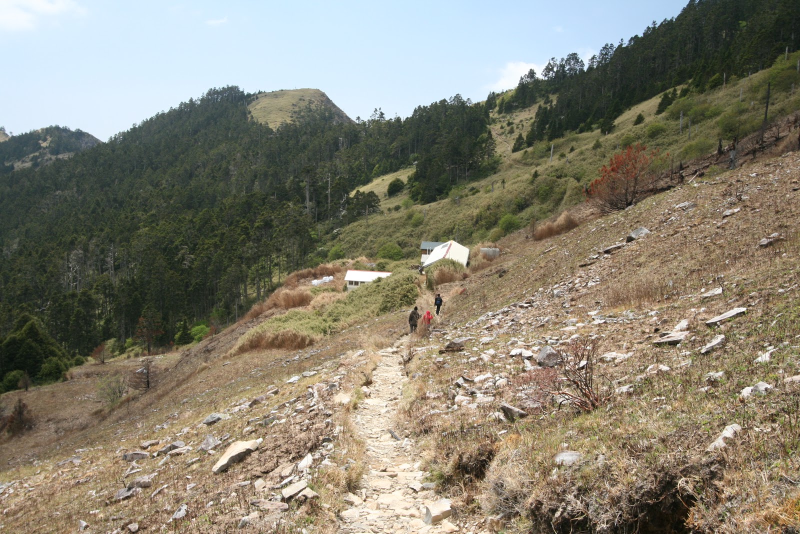
Descending is always much faster and the skies was clearing quite fast. The area between the 369 cabin and the forest entrance was quite bare. There was a big fire recently during our climb and the fire came very close to the 369 cabin. Remants of the forest fire still could be seen here.
 |
| Burned line where the fire was. |
 |
| 369 cabin in sight after leaving the Black Forest |
From the cabin, we packed up our sleeping bags and backpacks and started the hike back to teh trail head. The sun was coming out in full force and halfway through we were sweating and not longer feel cold. Under the sun it was warm, under the shade of a tree and it was chilly. What a nice way to warm and cool down.
 |
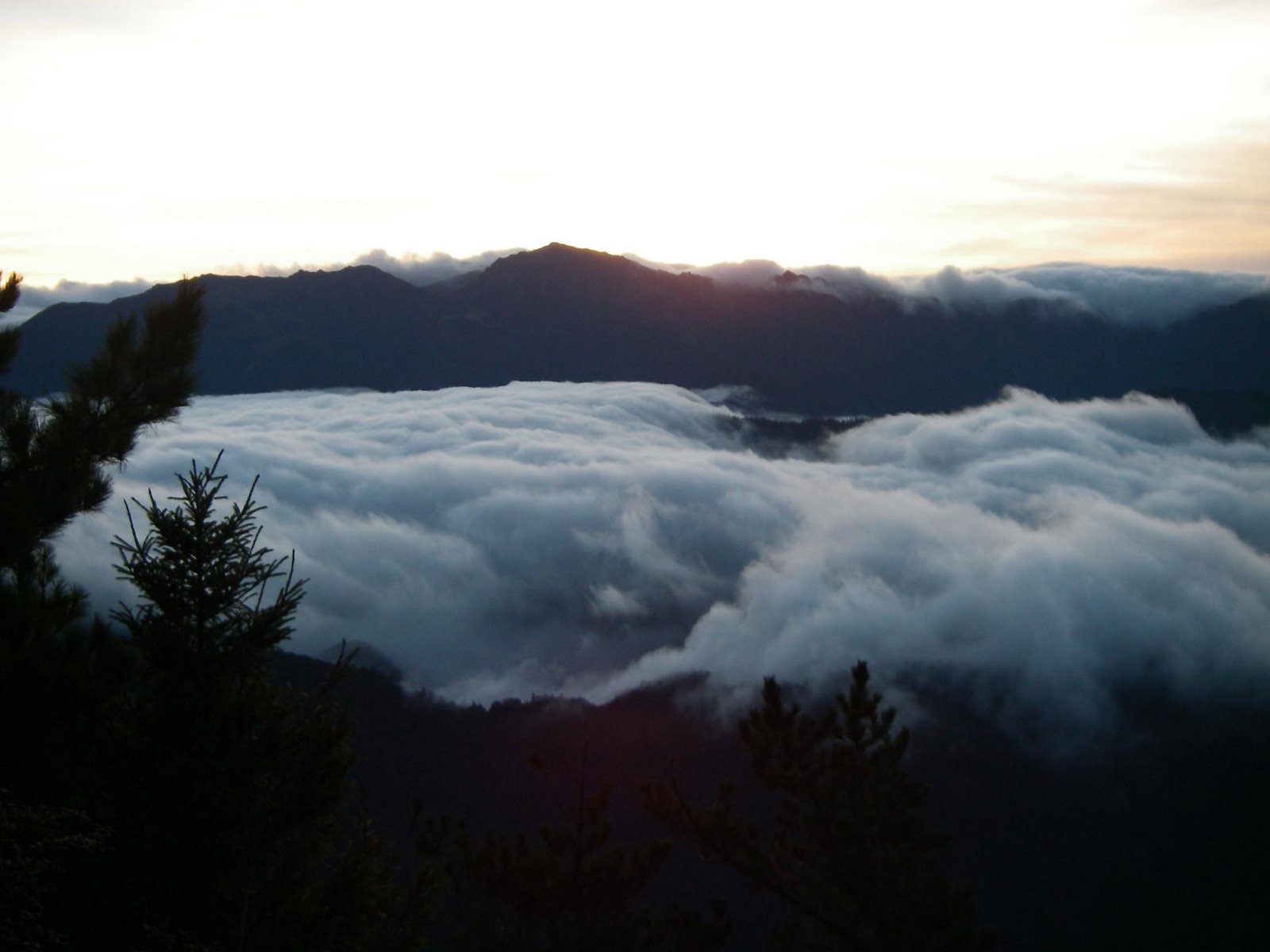
| On the ridgeline towards KuPo |
 |
| Smaller sea of clouds just crossing the mountain range |
Somewhere around 2pm, we reached the carpark and started the long drive alogn the east coast via the town of Yilan, going through the Snow Mountain tunnel and in no time, back in the city of delicious food and nite markets. I don’t think I have to say where we went after there.

Hi peanut!Dropped by to your blog.Interested to go for Xueshan hike but one operator told us the all-in price would be 17500 NTD.I personally think that it is quite expensive for me.Could you help to recommend?My email is afifzen@gmail.comThanks in advanceRegards
LikeLike
Hi Afif,I will email you seperately. The price of a climb also depends how many of you are climbing. But of course there are some out there that charges a different rate.
LikeLike
Hi Peanuts, was looking up for Xueshan and drop by your blog. I would like to know more info on how to apply permit? i am a seasoned hiker. Do drop me an email @ superhyperjoe@hotmail.comRegards and thanks in advance
LikeLike
Hi,Thank for your question. Will reply to your email separately
LikeLike
Hi Peanuts,I am going to climb Xueshan in September..It's the typhoon season so what is your recommendation?Have you ever hiked in taiwan during the typhoon season?
LikeLike
Hi sarah, I presumed you have gotten your park permit and mountain permit if you are climbing on your own. Are you climbing together with a guide? Typhoon season in taiwan runs from july to oct with oct being the ending part of the season. During these season typhoon may form in the pacific near Philippines and move into taiwan. As long as there is no typhoon detected it is safe to climb. You can check their weather bureau website at http://www.cwb.gov.tw and see if any typhoon forming and their projected path. Mountains will be closed to all access if typhoon alert is issued. Anyone in the mountain will be made to descend days before the typhoon lands at taiwan. Up there in the mountain is no joke when typhoons comes. Climbers can get blown off the mountain. Recently news u saw about the typhoon racking havoc within cities. It will be unthinkable if someone is up in the mountain. For locals it will be just cancelling the climb. But for overseas visitors like us. We will have to look for others things to do if we cant postphone the air tickets or hotel bookings.
LikeLike
Hi Peanut, I am looking for someone who can organize my group's climb to Snow Mountain next year, February. Can you email me at bananaq.boy@gmail.com. Thanks in advance.
LikeLike
Hi Peanuts! Appreciate the very informative post. A friend and I are planning to go to Taiwan this December and are thinking of climbing Xue Shan while we're there. Will be glad if you could provide me with some info 🙂 Can we communicate via email? My email address is amoeba001@outlook.com
LikeLike
Hi Peanuts! Appreciate the very informative post. A friend and I are planning to go to Taiwan this December and are thinking of climbing Xue Shan while we're there. Will be glad if you could provide me with some info 🙂 Can we communicate via email? My email address is amoeba001@outlook.com
LikeLike
Hi Ivan. I will reply to your email direct.
LikeLike
Hi Peanuts, Interesting and informative blog you have there. I am looking at climbing Snow Mountain in January next year… Can I get your guide/driver contact? My email is yi_qi_89@hotmail.com.Thanks in advance!
LikeLike
Hi. Thank you for your comments. Will reply to your email as stated
LikeLike
Hello Peanuts,Thanks so much for this blog of Snow Mountain. My friend and I are also from Singapore, and we are planning to hike Snow Mountain DIY in early Jan next year. Would it be possible for me to get your driver/guide's contact as well? Also, we have just applied for the park permit (awaiting approval) and are mostly concerned about the need for the trip leader to have a Snow Hiking certification to hike Snow Mountain in winter season. Can I check with you whether this is true? Our hiking experiences include hiking Mt. Rinjani and also a bunch of NS \”hiking\” experience.I am contactable at billylow1992@gmail.com. Thank you so much!
LikeLike
Hi billy. The months u choose to climb is like full winter. The mountain is closed for casual hikers and you need to have alphine snow experience to climb. Trails will be covered in snow and u need all the snow gear like boots with crampons. It gets difficult at the top and unlikely to get permit. On your own. The risks are there climbing in jan and weather is unpredictable in jan. Your clothing needs to be for winter snow trekking. I would say it is not a good mth to climb. And if the climb is just 2 of you. The cost willbe very high as guides do have minimum pax to cover the days and their profit margin. If you want to see snow and try the hehuanshan which are very simple climbs and accessible by transport. Still u need to have crampons on your shoes to wal on ice.
LikeLike
Hello Peanuts!Awesome blog! I'm from Singapore!, we managed to get our permit to hike only until East Peak in Early January. Just to enquire, at the trail head entrance, other than showing us a safety video about the mountain, and showing them the mountain entry permit, police permit, IDs, and basic outline of our route, do they check our equipments? I don't have any gps or satellite phone whatsoever. We're having difficulties in sourcing for places that rent crampons as well.May I ask, is there any transport to the trail head from wuling recreational area? I can't seem to find any information about it. Or would hitch hiking be an alternative way? Thank you so much!
LikeLike
Hi Peanuts!Thank you for such an informative post. I’m travelling to XueShan with a group of Singaporeans as well. We had gotten the mountain permit to climb until the East Peak during early January as well. May I ask, if your memory serves you well, aside from showing them the mountain entry permit, police permit, IDs, hike route, do we have to do a list of all our equipments? Will they be checking our equipments? I’m really worried that they would not let us in if we didn’t have some equipments (GPS, Satellite phone, Ice Axes, Crampons etc.) I personally do not have crampons and are still having troubles finding a place to rent some.Our approved route was to go from the trailhead to Qika Hut (spend 1 night), hike to the East Peak, and back to the trailhead.Thank you so much.
LikeLike
I never climbed during the winter months and not sure if they will check ur gear or not. At the wuling area at the trail head there is the place u need to watch a video and where they validate your permits. Is like a reporting station and when i descend. You have to report there as well so they dont activate entire village to look for you. Suggest you email and ask them about the checks. From your hike plan. They allowed u to reach the east peak only maybe because there shd not be much snow. The hike to east peak is hands free and u can just walk without using hands maybe in winter. At 3100m, maybe there is little snow. You have to ask them about the condition during the climb period and if the need on crampons. There are limited buses that ply between wuling to yilan i think or lishan. You can google abit as i recall coming across that previously. Suggest u book accommodation at wuling recreational farm area before the climb as the bus timing may not suit you climb plans. Do prepare for winter hikes. Your sleeping bags, mats, clothing is enough. Look out for the trail markers as you hike to stay on the track.
LikeLike
Try to google in chinese. You shd find the bus timing.
LikeLike
Hi Peanuts, Thanks for the informative post and the beautiful photos. My friends and I are planning to do a trek up Xueshan. Will greatly aprreciate if you could share with us some of your contacts and info. My email is sufiyan_armita@yahoo.com. Looking forward to hearing from you!
LikeLike
Hello there. Gotta say, lovely lovely blog you have here. Very informative as it is interesting to read. I plan to hike Xueshan as well next year, but if possible without guide service. How much of a hassle would that be? And what do I need to pay apart from transportation and permit(?). Thank you in advance, Peanuts. You can email me too at abdulhadia698@gmail.comThanks!
LikeLike
Hi,Yes you can. The standard trail to xueshan main peak.is frequent by foreign climbers as well. Because the trail is so popular and safe, you can climb on your own. Just make sure to apply the park permit which comes with the lodge accommodation and the mountain permit (police). All the info is found on the sheipa national park website. They do have that in english. As long you climb in the non winter months where there is no snow. Permits will not be a problem. But do apply when the application window opens.
LikeLike
Hi Peanuts, thanks for the info on Xueshan. My friend and I have obtained our permits and are looking for just a guide to help us navigate our hike in late August. Could you provide any contacts who can help us? Thanks in advance.
LikeLike
Hi, may i know how many of you. And are you doing thr xueshan east n main peak? The cost for just 2 person can be high. If it is for this trail. Usually you dont need a guide as the trail are clearly marked. And the route is very popular and touristy. So for the summit from 369. You can start off behind trailing the other groups to te summit. Follow the same trail back to 369. If you have done trekking at this altitude before and have a good sense of following the trail. It shd not be a problem. Take note late august is still typhoon season. Do not go in when typhoon hits. Anyway you need to report to the park ranger station before starting off. You also need to apply for mountain permit. It is a combi.of both. Park and mountain. The bedding allocation at the huts usually comes with the park permit. I can email u the guide to get a quote. You can also drop a message in the response form at the bottom of the blog. I will email u and the guide together. But do not cost for 2 pax can be high. But the guide provide all transport, insurance and safety plus meals ( except lunch).
LikeLike
Thank you for this article peanuts! Very informative. By the way, we (3 of us, non-chinese speaking) are planning to climb snow mountain this coming january 2017. We dont have snow climbing experience so we need your help on this please. Hope you can share with us or recommend to us your guide. You can drop me an email at rachellemaecong@gmail.com. Would greatly appreciate your help! Thanks!
LikeLike
Hi,January is winter and the mountain could be frozen. Hence requiree ice climbing experiences and the park permits will be more stringent. For the guide i can help to ask the guide if he is comfortable leading english speaking climbers.
LikeLike
Hi Peanuts,Thanks alot! Will wait for your update 🙂
LikeLike
Hi Peanuts, we're planning to hike at east and main peak on Feb next year. May I know if we need to obtain mountain permit and to have a guide? Kindly share me your hiking guidelines in my email jdaguas0429@gmail.com. Thank you.
LikeLike
Park permit is the that has the dependencies if you can get mountain permit. The park permit depends on tge lodge vacancy. And your applucation need to include the route and your experience. Xueshan can be climbed without a guide. You can visit the park website in english to learn more about the application and the forms to download to fill in. Only when u get the park.permit then you can apply the mountain permit from their police agency website.
LikeLike
Please see my reply below.
LikeLike
Hi Peanuts,I am looking for a guide to lead a group of 3 for Mount Syue on 28-30 Dec. Please do let me know if you have any one to recommend. Thank you very much!I can be reached at eunicewaves8@gmail.com
LikeLike
Hi,Will reply to you via tge email u mentioned.
LikeLike
Hi Peanuts! Thanks so much for sharing the experience! Can you possibly also share with me your guide contact?My email is karenraearnoco@gmail.comMy friends and I are planning to go to Taiwan between Feb 27 to March 2, 2017 and is looking for someone who can help arrange the hike. Thanks so much and hope to hear from you! :)Cheers,Karen
LikeLike
Hi we are coming to Taiwan this coming 11-19 Mac and looking forward to scale the Xueshan Mountain.We had ask around but no one wanted to take us. There is only two of us in the group and as for experience we had climb the Mount Kinabalu, Day Climb Fansipan-Vietnam February last year, and we reach Everest Base Camp last september. We are both certified with high ropes skill.Can you arrange it for us?do email me at meltina86@yahoo.com
LikeLike
hi, will reply to you seperately. thx
LikeLike
Hi peanut can u provide me with your guide contact? I would like to hike in taiwan in nov. Thanks v much! Littleviper6@gmail.comAdeline
LikeLike
hi adeline, i will email you directly and able to provide some advise on the climb.
LikeLike
Hi Peanut, Can u provide me with your guide contact as wel as the price for the xueshan climb for a group of 4 to 6 ppl? I would like to hike in taiwan xueshan in Jan 2018. Thanks v much! Appreciate it if i could get some advice from u for the climb as well.I can be reached at mjkk89@hotmail.comKK
LikeLike
Hi Peanut,Could you provide me with your guide contact and the pricing as well for the XueShan climb for a group of 4 to 6 ppl? I would like to make the hike in taiwan in January 2018. Appreciate it if you could give some advise for the Xueshan climb as well. Thank you very much for the help and time provided. :)With Regards,KK
LikeLike
Hi,Will link you up with the guide and provide some advice on the climb as well. will email you directly.
LikeLike
will reply to you direct.
LikeLike
Is it possible to do Xueshan without a guide?
LikeLike
yes you can if the national issue you with the park permit which depends on bunk bed vacancies based on the hike route and accomodation location at the lodge. mountain permit to apply seperately. stay on the path and follow the signboards. shd be safe.
LikeLike
Hi PeanutsI am lookin at climbing xueshan 16 nov to 22 nov. Mind if u can give the contacts of your guide? We are a group of 3 pple =)My email add is jadepipelee@hotmail.comThank you. Rather last minute planning, but i hope it is in time! =/
LikeLike
Hi, will reply to you separately for your Xueshan Climb.
LikeLike
Hi Ms. Peanut,Thank you for your wonderful blog! My boyfriend and I were planning to Climb XueShan Mountain this January 2018, I was hoping if you could you provide me with your guide contact, rates and some advice for the Xueshan climb as well. I can be reached at may.escol@gmail.comThank you very much in advance!BR,May
LikeLike
thanks for your question. i will reply to you directly.
LikeLike
Hi Peanut, could you provide me with the info as well? Thank you! =) bestof.me@hotmail.com
LikeLike
Hi Ms. Peanut,Planning to hike Xueshan next year before visa free expires, hoping you could provide me details for the said climb. Here is my email address, ericsonranchez@gmail.comThanks in advance =)
LikeLike
Hi Meici,I will email separately to you. But would need you to be more explicit on what info you need.
LikeLike
Hello Doc Eric,I will reply to you email separately
LikeLike